

|
||
|
||

Chinese automobile conglomerate Geely has made significant strides since I last wrote about their Geesat LEO constellation for mobile vehicle connectivity. They launched the first nine satellites in June 2022 and a second batch of eleven satellites in February 2024. The mass of the first nine satellites was 100 kg, and the mass of the second eleven was 130 kg, so they are not identical.
Today, they have twenty satellites orbiting at 600 km with a 50-degree inclination, and the recently launched eleven are equipped with “artificial intelligence” remote sensing capabilities, allowing them to capture clear high-resolution images with a resolution ranging from 3.2 ft to 16.4 ft. These satellites can provide data and imagery for multiple applications, including surveillance, urban planning, and infrastructure management.
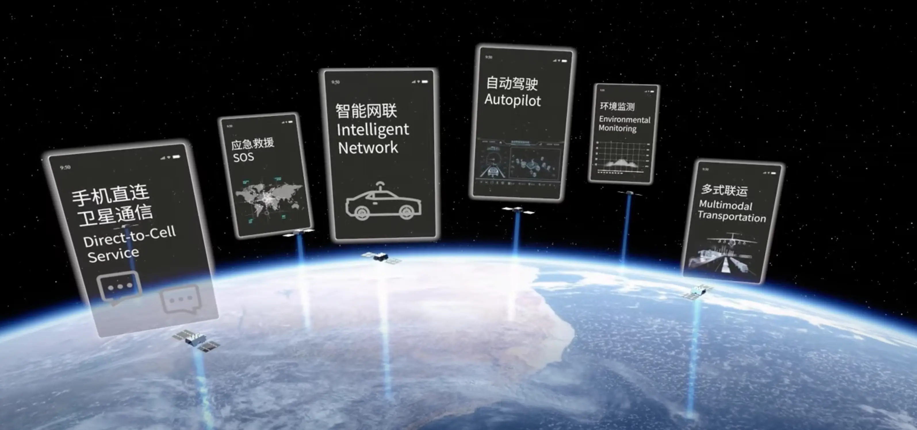
These satellites are the first of a 72-satellite first-phase constellation. The company plans to provide “global real-time data communication services” once the 72-satellite first-phase constellation is completed next year and “global centimeter-level positioning services” when the 168 second-phase satellites are in orbit at an unspecified time.
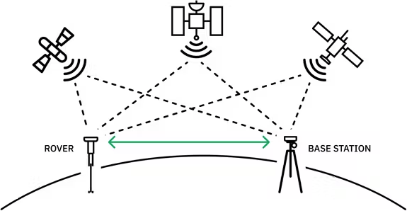
Centimeter-level positioning would be impossible using only GPS (or BeiDou) satellites that orbit at around 20,000 kilometers, but Geely is planning to use RTK-PPP (Real-Time Kinematic and Precise Point Positioning) to provide centimeter-level positioning accuracy for GPS satellites.

As shown here, RTK-PPP augments location data from multiple satellites with the rover’s position relative to a terrestrial base station. (The rover could be an autonomous car, truck, crop harvester, etc.).
One can imagine base stations along highways, freeways, and even in cities, but that would require investments by governments at all levels, auto producers, and other private companies. It would also need standards that are compatible with all GNSS systems. This will not happen overnight, but I am not surprised to see Geely leading the way because:
A final note—several of the references in this post are to Blaine Curcio’s China Space Monitor. Check it out if you are interested in what China is doing in space. I also used but took with a grain of salt, conversations with ChanGPT: chat1 and chat2.
Sponsored byIPv4.Global

Sponsored byWhoisXML API

Sponsored byDNIB.com

Sponsored byRadix

Sponsored byVerisign

Sponsored byVerisign

Sponsored byCSC
